Pages

Sunday, May 12, 2013

Day 4, High River, AB to Whitecourt, AB

May 12  After a good nights rest in High River, we broke camp and left 8:15 a.m.  We headed north on Hwy 2 to Calgary and on towards Edmonton, AB.  Good travel weather with a strong tail wind helped to make up for the previous day's head wind.

Traffic today is very busy.  I swear that on this Mother’s Day (BTW, Happy Mother’s Day to all of your who are a mom) the populations of Calgary and Edmonton must swap places as traffic was nearly bumper to bumper going both north and south.

Most of the land is still agricultural, farming and ranching, but you can tell there are transitions.  We are finding larger and larger stands of trees, both birch and pine, and more lakes mixed in with farming.  The Canadian shield is spreading out before us.

The Milepost, an annual periodical, routed us around Edmonton.  It was a good find.  Am glad that Peggy is attentive to the little details as going south of, and then west of Edmonton was a traffic saver!

West of Edmonton we get on the Yellowhead Hwy for about 30 miles.  We then took Hwy 43 north.  As I told Peggy we no longer have to worry about getting lost from this point on as there is really only 1 highway in Alberta and 1 highway in British Columbia and the Yukon taking us into Alaska.

Speaking of getting lost.  The Canadians are very friendly people.  But their signage leaves a lot to be desired.  I’m a coffee drinker...OK...heavy coffee drinker even when I’m driving.  So after a while nature comes a calling and I need a pit stop.  No pits can be found to stop at.  So after what seemed a VERY long time a Rest Area sign!  Whew!

I pull off on the ramp per directed.  At the stop sign turn left which takes us back over Hwy 2.  Another sign- turn left...we are now on the southbound ramp to Hwy 2!  Off to the right we can see the Rest Area but we are committed to going south.  About 1.5 km on Hwy 2 is an exit ramp which takes us to the little town of Bowden.  Bowden came to my rescue as there in the middle of town is a gas/diesel station...with REST ROOMS!!  Of course if it were needed we do have a bathroom in tow with us.

Back to our journey.  We begin heading north and northwest on Hwy 43.  Very nice scenery with lots of trees and small lakes and occasional farms and ranches.  We go about 150 km and come to the town of Whitecourt, AB.

Peggy finds info on another Lions Club campground on the south edge of town.  Very nice with electricity and water hookups...and wifi!  Now we can upload 2 days worth of information along with photos to our Picasa account.

We set up camp and then go into town so that Peggy can get a Mother’s Day ice cream.  We find “Granny’s” in town and have a double dip bowl!  YUM!  We then drive down to a park along the confluence of the Macleod and Athabaska Rivers.  It was a bit windy with cold rain drops falling so we didn’t stay there long.

Hopefully the wind will die down so we can have a campfire tonight!

1799 miles to Wasilla!!  Yup...we’re still enjoying every mile of it!


Day 3, Lewistown, MT to High River, AB

May 11  We left Lewiston, MT, about 8:00 a.m.  We drove through rolling hills and foothills providing good cattle range land.  We remark that the majority of the herds are made up of Angus.  We bet that Peggy’s brother and nephew would be proud!  We are able to see snow capped mountains to the west as we make our way toward Great Falls, MT.

At Great Falls we pick up I-15 north.  As soon as we climb out of the Missouri River basin, the topography changes drastically.  We are now in prime wheat growing country.  The land is made of gently rolling hills where we see the farmers doing field work.

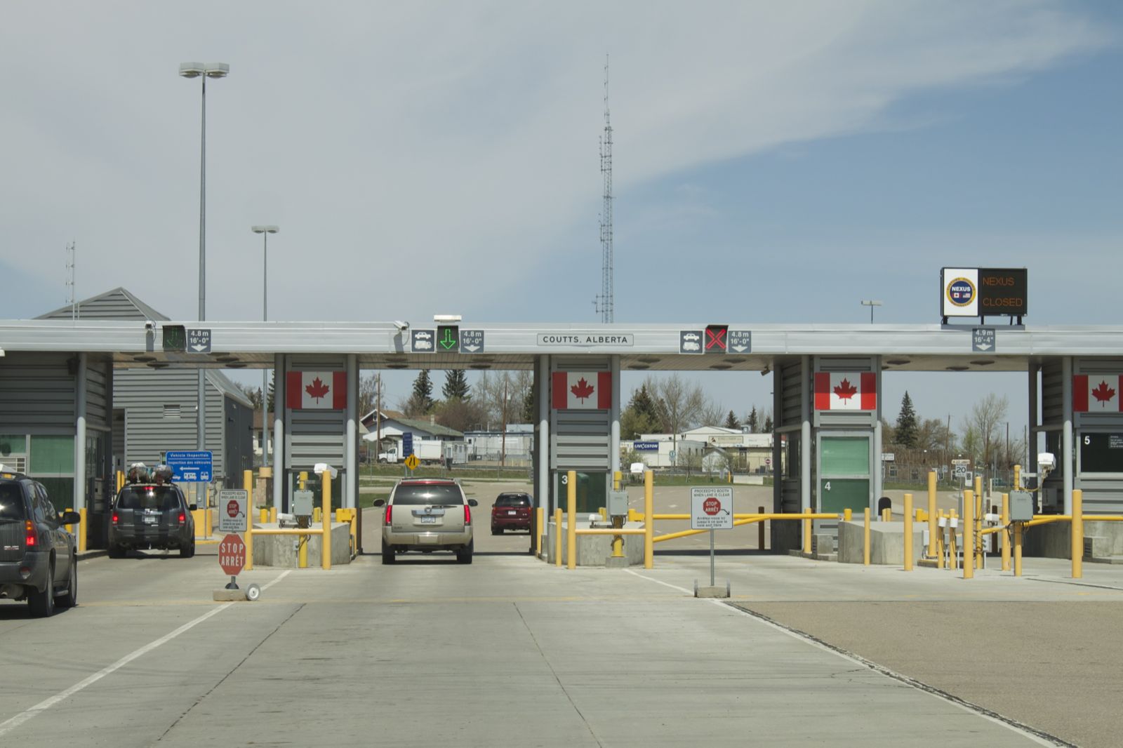
At Sweet Grass, Mt, we come to the US/Canadian border.  We get in line with a couple of vehicles ahead of us.  Each of them are directed into the Vehicle Search parking lot!  Our turn...  


The Canadian border guard takes our Passport cards, and asks about where we are headed, if we have any liquor to be left in Canada, if we have firearms, if we have mace or pepper spray.  We tell him about our bear spray and he asks if it is clearly labeled.  Yes, it is.  We answer his questions, and he returns our cards and wishes us a safe journey in Canada and waves us through.  Whew!

From there we drove through Lethbridge, AB, and on north, northwest.  We stop at a gas station to use the ATM so that we have Canadian money.  Onward!  We make lunch in a truck parking lot as all the Visitor Centers are closed.  We must be too early for their season to have started.

Peggy locates a very nice Lions Club run campground along the edge of High River, AB, just south of Calgary.  We are informed at the office to be sure and fill our water tank as they have very good spring water.  I can’t tell if it is good or not, maybe because it is mixed with the Omaha water we had onboard.

We traveled almost 400 miles today.  The Canadian speed limits are not as generous as  in the USA.  Getting use to kilometers per hour, purchasing fuel by the liter, and Celsius degrees will be a bit of a challenge for us to get used to.

According to my GPS we have 2128 miles left to Wasilla, AK.  Tomorrow we should be able to get northwest of Edmonton, AB.  Edmonton is the farthest point that we have been to before.  From there on, we will be in new territory, and we will slow the pace so that we can play the part of tourist.  

BTW, the weather today was quite warm.  A good south (tail) wind was blowing, and with it came warmer temperatures.  It was about 78º F. here in High River when we arrived at 4:30.  Tomorrow they are predicting temps in the mid 80s F.  And this afternoon my iPhone weather alert for Omaha indicated a frost advisory for tonight (Sat.)!  You need to come north, eh (āh)?


Friday, May 10, 2013

Day 2, Spearfish, SD to Lewistown, MT

May 10  We left Spearfish around 7:30 a.m. and continued on I-90 West.  Leaving the Black Hills behind we entered drier, sage brush covered hills.  When passing Gillette, WY, we were reminded of last night's news coverage that the open pit coal mines in this area were on the verge of shipping their 10 billionth ton of coal.  If my math is correct that is 10,000,000,000 tons!  Geologist have predicted that there is enough coal remaining to easily achieve 100 billion tons!  Peggy and I passed this area on our honeymoon in 1973, and they already had a significant hole in the ground.  Can't imagine what the size of the open pit must be now.  But if we stop and revisit things we have been to previously we'll never make it to Alaska in a timely fashion.

Continuing in a westerly direction we saw the Bighorn Mts. west of Buffalo and Sheridan, WY. This is the earliest in the year that we have seen the Rockies, and they are snow laden- very pretty.  However, since we had been there, done that with camping, and seeing the Medicine Wheel, etc., on other trips to Wyoming, Peggy snapped some photos of them through the pickup's window.  If they turned out, we will post them on our Picassa web site to which the hot link is found in an early post.

OK...had to try the photo feature.  So, here is a pix Peggy took going 62 MPH down I-90!  She even missed the bug splatters on the windshield!
Bighorn Mts near Buffalo, WY


At Buffalo I-90 turns to the northwest.  About 20 miles north of Buffalo, a predicted cold front moved through and with it came northerly winds blowing at about 20-25 MPH.  Oh well, we drove all morning with no interference from the wind.

Past Sheridan, WY, we entered Montana.  We drove past the Custer National Battlefield.  You could easily see the little white markers in the cemetery.  However, we had been to the battlefield on the banks of the Little Bighorn River during an earlier excursion.  And, since our goal again today was to cover territory we drove on.  I do recommend to anyone that you visit this great historic site.  It would be well worth your time.

We connected with I-94 west and followed it to Billings, MT.  There we left the ease of Interstate driving and took Hwy 87 north and west.  We have stopped for the night in a campground in Lewistown, MT.  Tomorrow we head to Great Falls, MT, pick up I-15 north, and should make it into Canada!

Todays mileage was about 400 miles traveled.  Approximately 2600 miles to Wasilla!  And yes...we are still having fun!!  It will be interesting to see if I continue with this mileage thing and whether or not I can keep up the dialogue.  If not, I'm sure my navigator would also take over the role of commentator!


Thursday, May 9, 2013

Day 1, Omaha to Spearfish, SD

May 9  I can't tell you how hard it was to sleep last night!  Not that the trip had us worried, but you wonder what you might have forgotten to do for prepping the house to be empty for 4 months!  And then to top it off, it was thundering off and on during the night.  Shheeeeez!  :o)

Peggy and I loaded up and were on the road at 6:58 a.m.  Just as we were to leave, we got to say goodbye to Peggy's sister, Donna, one more time as she was just leaving the neighborhood for who knows where at that time of the day.

This day was basically putting the cruise control at 62 MPH and steering.  We got onto I-29 north and got into some rather heavy fog.  Then the fog turned to drizzle, and the drizzle to rain.  We drove in rain on and off all the way to Sioux Falls where we picked up I-90 west.  We continued in and out of rain/drizzle until Chamberlain, SD.

Then the sun came out, the temps rose from the 40's into the 60's all the way to Spearfish, SD.  After about 11 hours we decided to stop.  We are camped at Chris' Campground.  Very nice digs...all the amenities of home- water, electricity, sewer (yum!), Internet, and best of all...cable TV!

Today was to cover territory which we did quite well.  We drove 568 miles.  Between Omaha and here  we have generally seen it all over the years of camping.  So we bade the Badlands and Black Hills an adieu and kept going.

Tomorrow will be much the same...cover territory.  Why 62 MPH you ask??  Our diesel pickup will lock up the torque converter in 6th gear giving us the best fuel mileage.  We don't ask for much...but if Mother Nature could provide us a tail wind, it would help increase the distance traveled between fueling stops!

Miles traveled: 585
Miles to Wasilla, AK:  just less than 3000


Thursday, May 2, 2013

May 9 Will Be the Departure Day


Departure day is a week away!  We are excited!

The 5th wheel trailer will be loaded and all the maintenance needs for the pickup attended to.  We are changing our original routing from going through North Dakota to going to Sioux Falls, SD, and then west on I-90 to Wyoming and Montana, and then into Canada via I-15.  Flooding along the Red and Souris Rivers in ND, and the potential for detours prompted our change.  Here is our tentative route.

One of the hardest things to do will be to leave family for an extended period of time.  However, Shelly and Becky have given us their blessings to undertake this adventure.  And hopefully, technology when available, will allow us to stay in touch via the cell phone and Skype.  We have to keep up with what our granddaughters are doing!!

We will have the house prepped for its 4 month suspended animation: water to be turned off; newspaper, cable, and satellite TV cancelled during our absence; and mail forwarded to our temporary address in Wasilla, AK.  Wonder what we're missing??

We can't imagine what the early pioneers with their covered wagons must have felt when traveling the Oregon Trail.  We might have similar feelings as we leave for our trip, yet we travel with modern conveniences.  We will hope and pray for a safe journey!

Our Alaska Blog Information

Blog Information
As Internet connection services will be sporadic to nonexistent when we are traveling, updates to this blog will follow suit.  We hope to have cable Internet when we are on duty in Wasilla.  Peggy and I invite you to return to this blog periodically to see if we have posted updates.

Photo Information
We may attempt to include some photos within the blog, but a majority of our photos will be found at:
https://goo.gl/photos/wnrVJpsDybTJbsCR7

Subscribing
Those of you who want to keep up with changes to this blog via email notifications can scroll to the bottom of the Home page and submit your email address.  Just follow the instructions.  You'll get a confirmation email with a confirming link to click.

Comments
We've added a Comment pop-up box to our blog.  We'll try to remember to include it with each new update we add.  The Comments will need to be approved by us before it will get posted (if I have the settings correct).  Again, be patient as we will be in places with no Internet for large chunks of time.

Friday, March 8, 2013

In the Beginning, March 2013

In the beginning we were thinking our 2013 RV vacation would be to the Southwestern States as we had never been to the Grand Canyon or the national parks of California and Utah.  We happened to be at AAA getting maps, tour and campground books, when Peggy randomly picked up cruise brochures to Alaska.  Going to Alaska is one of those things on our bucket list, but we never seriously considered it as there are areas of the lower 48 states we wanted to see.

AAA happened to be offering a special on a cruise to Alaska but there was a due date for signing up.  Since we were at AAA, one of the assistants gave us the details.  We went home thinking maybe this was the year to take a cruise north.  We sat and thought through going on this 17 day cruise.  Figuring the cost of the cruise, plus airfare to Vancouver along with travel insurance, the cost for us was significant.  And the number of days seemed very limiting considering all that Alaska could offer.

I did some rough estimating of what our costs to drive our pickup and 5th wheel trailer might be, and those dollar amounts where less than the cruise.  One of the other deciding factors was that the cruise was only 17 days.  We could RV to Alaska and stay as long as we wanted.  

So, the Grand Canyon went on the back burner, and we began planning our 2013 vacation to Alaska.  Back to AAA for maps taking us 3000+ miles northwest!  Game on!  Route and timeline planning began along with searching the Internet for information, ideas, and tips.

While perusing the RV.net forum I came upon a posting advertising a part time job in Wasilla, AK.  Wasilla is about 40 miles north-northeast of Anchorage.  The job involved being property caretakers from Memorial Day to Labor Day on Sundays and Mondays in return for free RV hookups: electricity, water, and sewer.  The other five days of the week we would be free to travel and tour around at our discretion.  I quickly showed Peggy this posting, and she did not say, "No"!

As property caretakers, we would be watching a private general aviation repair facility that caters to float planes.  We would be on hand in the event either a repaired plane was ready for pickup on Sunday or Monday, or be available to assist in the event a float plane landed on the adjacent lake needing to be repaired.  The owner indicated that there had only been maybe once in the past two or three years that there was a situation where a plane actually was picked up or came into the facility.  The owner would be able to take Sunday and Monday off to fly to their cabin located on a remote lake knowing the caretakers would be on the premises.

After a couple of phone calls to the proprietor, emailing questions to the previous year's caretaker, and visiting with our daughters, we were offered the opportunity and agreed to take it.  Obviously this elongates our initial vacation timeline.  We originally thought we would be gone maybe up to three months, but now we will be gone closer to four months.  

We have quite a bit to think through before departing: pickup maintenance, prepping the house for 4 months of inactivity, yard care, etc.  But we are excited for this new chapter in our lives during our retirement.  We are feeling blessed to have been accepted for the caretaker position and all the opportunities that await us.